Political Map of Africa
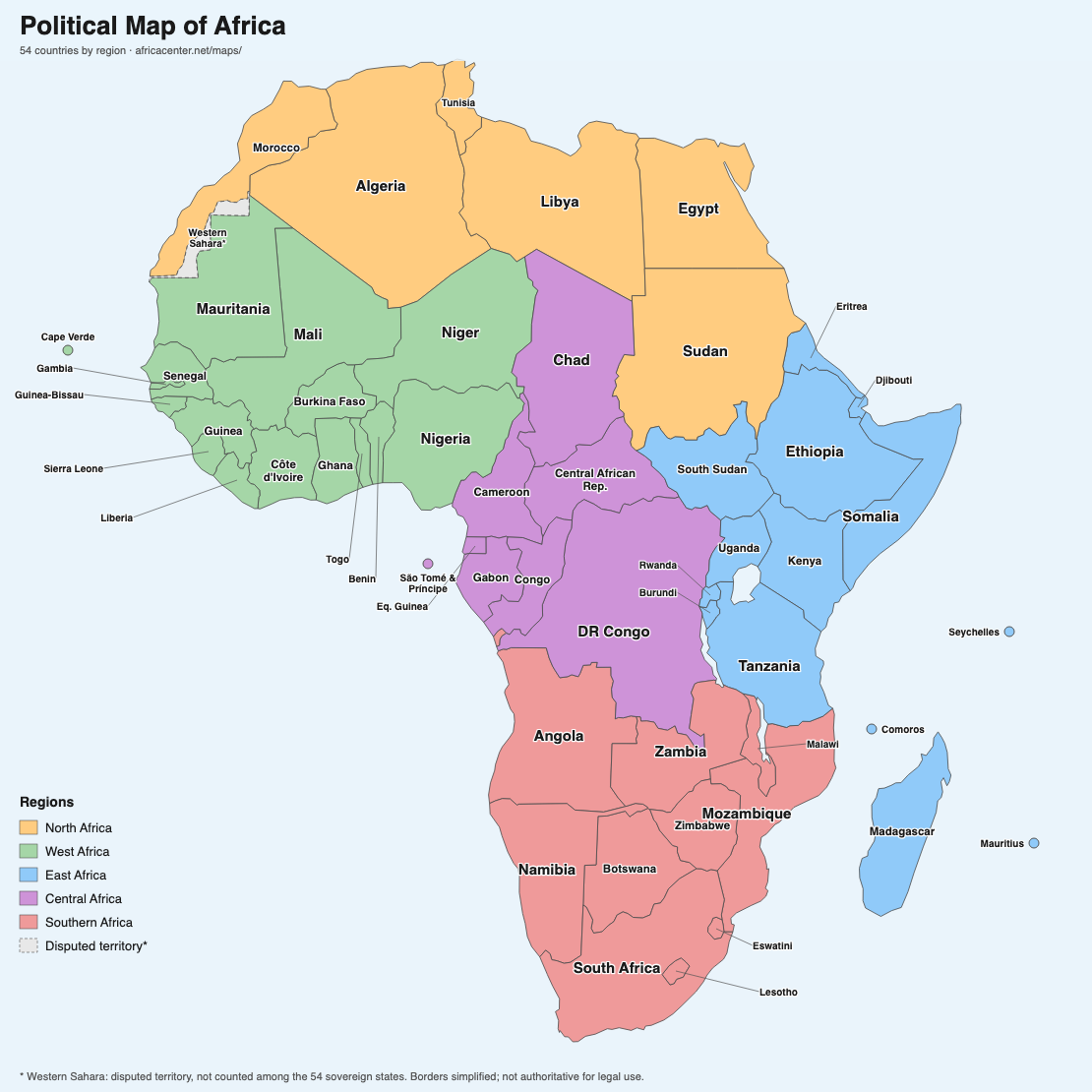
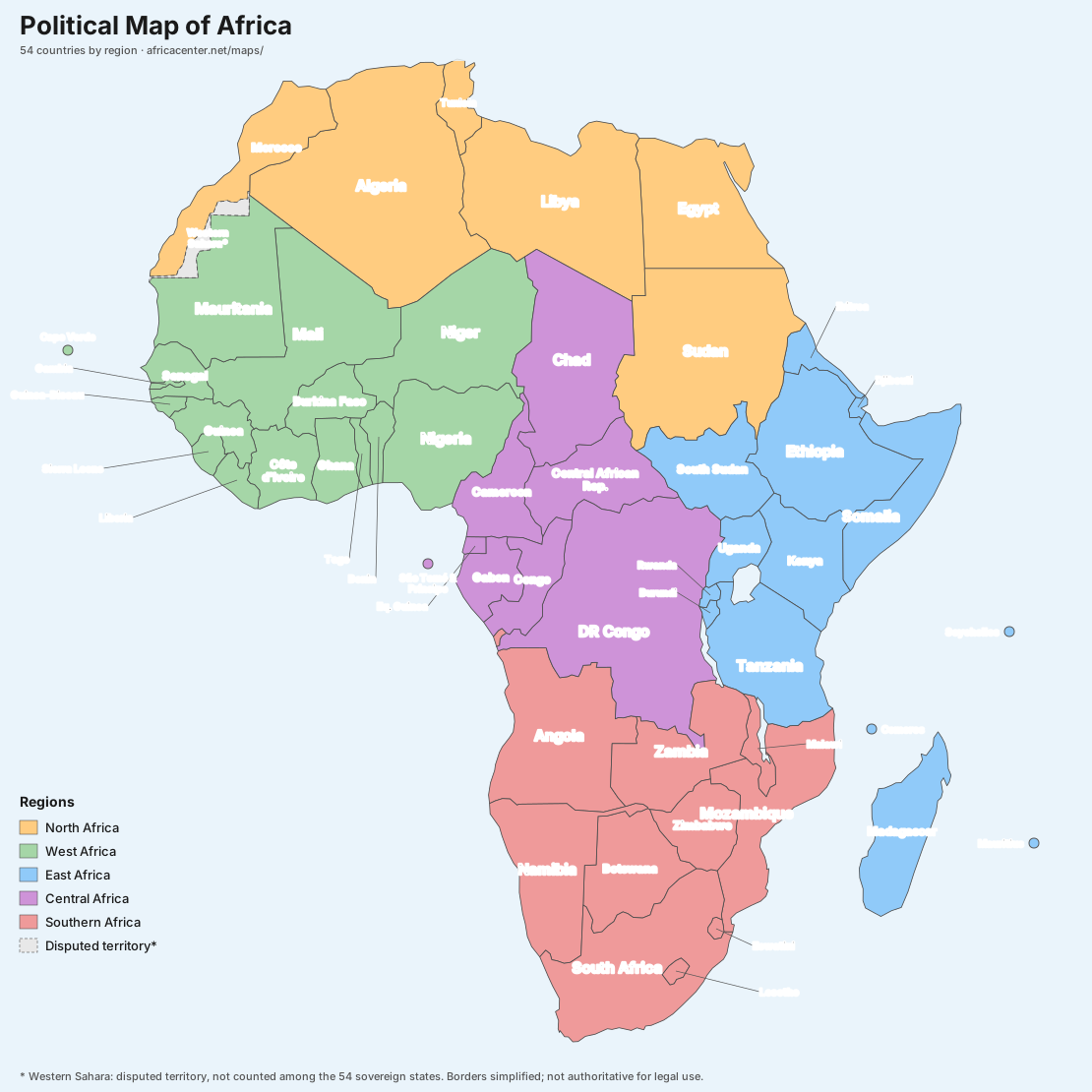
The political map below shows the borders and names of all 54 African countries, coloured by region, with the island nations of Cape Verde, São Tomé and Príncipe, Comoros, Mauritius and Seychelles marked. Western Sahara is shown as a disputed territory.
A Complete Interactive Map of Africa
This interactive map of Africa plots all 54 recognised countries across the continent. Click any country marker to see its capital, population, GDP and land area, or use the search box and the regional Quick Navigation buttons to jump straight to North, West, East, Central or Southern Africa. Every country on the map links through to a full profile with the latest statistics.
Africa is the world's second-largest continent, home to about 1.5 billion people spread across more than 30 million km². Cartographers and the United Nations group its countries into five regions, and the map above is colour-coded to match. For a sortable directory of every nation with population and GDP side by side, see the full list of African countries.
African Countries and Capitals by Region
All 54 countries shown on the map, with their capital cities, grouped into Africa's five regions. Select any country to open its data profile.
North Africa 6 countries + 1 territory
- 🇩🇿 Algeria Algiers
- 🇪🇬 Egypt Cairo
- 🇱🇾 Libya Tripoli
- 🇲🇦 Morocco Rabat
- 🇸🇩 Sudan Khartoum
- 🇹🇳 Tunisia Tunis
- 🇪🇭 Western Sahara El Aaiún
West Africa 16 countries
- 🇧🇯 Benin Porto-Novo
- 🇧🇫 Burkina Faso Ouagadougou
- 🇨🇻 Cape Verde Praia
- 🇨🇮 Côte d'Ivoire Yamoussoukro
- 🇬🇲 Gambia Banjul
- 🇬🇭 Ghana Accra
- 🇬🇳 Guinea Conakry
- 🇬🇼 Guinea-Bissau Bissau
- 🇱🇷 Liberia Monrovia
- 🇲🇱 Mali Bamako
- 🇲🇷 Mauritania Nouakchott
- 🇳🇪 Niger Niamey
- 🇳🇬 Nigeria Abuja
- 🇸🇳 Senegal Dakar
- 🇸🇱 Sierra Leone Freetown
- 🇹🇬 Togo Lomé
East Africa 14 countries
- 🇧🇮 Burundi Gitega
- 🇰🇲 Comoros Moroni
- 🇩🇯 Djibouti Djibouti City
- 🇪🇷 Eritrea Asmara
- 🇪🇹 Ethiopia Addis Ababa
- 🇰🇪 Kenya Nairobi
- 🇲🇬 Madagascar Antananarivo
- 🇲🇺 Mauritius Port Louis
- 🇷🇼 Rwanda Kigali
- 🇸🇨 Seychelles Victoria
- 🇸🇴 Somalia Mogadishu
- 🇸🇸 South Sudan Juba
- 🇹🇿 Tanzania Dodoma
- 🇺🇬 Uganda Kampala
Central Africa 8 countries
- 🇨🇲 Cameroon Yaoundé
- 🇨🇫 Central African Republic Bangui
- 🇹🇩 Chad N'Djamena
- 🇨🇩 Democratic Republic of Congo Kinshasa
- 🇬🇶 Equatorial Guinea Malabo
- 🇬🇦 Gabon Libreville
- 🇨🇬 Republic of Congo Brazzaville
- 🇸🇹 São Tomé and Príncipe São Tomé
Southern Africa 10 countries
- 🇦🇴 Angola Luanda
- 🇧🇼 Botswana Gaborone
- 🇸🇿 Eswatini Mbabane
- 🇱🇸 Lesotho Maseru
- 🇲🇼 Malawi Lilongwe
- 🇲🇿 Mozambique Maputo
- 🇳🇦 Namibia Windhoek
- 🇿🇦 South Africa Pretoria
- 🇿🇲 Zambia Lusaka
- 🇿🇼 Zimbabwe Harare
Frequently Asked Questions
How many countries are on the map of Africa?
There are 54 fully recognised sovereign countries in Africa, and all 54 appear on the map above, grouped into five regions. Western Sahara is shown as a disputed territory and is counted separately by some organisations.
What are the five regions of Africa?
Africa is commonly divided into five regions: North Africa (6 countries, plus the disputed territory of Western Sahara), West Africa (16), East Africa (14), Central Africa (8) and Southern Africa (10). Use the Regions buttons on the map to fly to each one.
What is the largest country in Africa?
Algeria is the largest African country by land area, at roughly 2.38 million km², followed by the Democratic Republic of the Congo and Sudan.
Which African country has the most people?
Nigeria is the most populous country in Africa with about 230 million people, ahead of Ethiopia and Egypt. Click any country on the map to see its current population.